Description
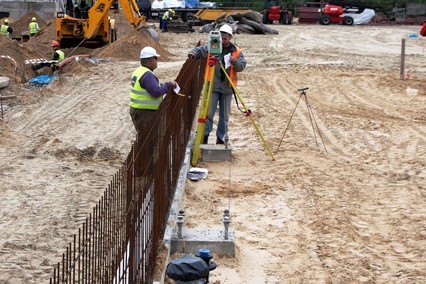
Land surveyors or simply surveyors are required to work on civil engineering projects. They need to collect data about features of the landscape for engineers, including positioning of objects, land contours, and materials below earth’s surface. Land surveyor use different methods to gather data needed for construction, such as geomechanic and geomatic surveys, geospatial measurements, and feasibility surveys. They can work for property development companies, surveying firms, building societies, banks, local government departments, among others.
2. Analysing data using plans, maps, charts and computer applications such as CAD and GIS
3. Presenting data to clients
4. Advising about technical matters and whether the construction plans are viable
5. Writing reports
6. Managing projects and/or multi-disciplinary teams
7. Producing and/or advising about construction plans and drawing
The United States of America: $41,904 per year
Australia: AU$65,326 per year
Tasks:
1. Undertaking land surveys/measurements by using a variety of specialist technical equipment (including, theodolites, laser alignment devices, satellite positioning systems etc.)2. Analysing data using plans, maps, charts and computer applications such as CAD and GIS
3. Presenting data to clients
4. Advising about technical matters and whether the construction plans are viable
5. Writing reports
6. Managing projects and/or multi-disciplinary teams
7. Producing and/or advising about construction plans and drawing
Key skills for land surveyor:
- Knowledge about safety regulations
- Good time management skills
- Good written and spoken communication skills
- Problem solving skills
- Maths and IT skills
- Knowledge about CAD programs and surveying technology
- Accuracy
- Analytical skills
- Strong communication and interpersonal skills
Average salary (2014):
The United Kingdom: £23,723 per yearThe United States of America: $41,904 per year
Australia: AU$65,326 per year
Qualifications and training required:
The educational requirements needed to become a land surveyor can vary from licensing body to licensing body and from employer to employer. The most common education needed to become a land surveyor is a four-year bachelor’s degree in the field of Geomatics Engineering. Land surveyors also need a good understanding of mathematics, physics, cartography, earth sciences and computer programming in order to become successful in their careers. Any previous relevant work experience gained via job shadowing, vacation work or placements can be helpful, and can contribute towards vocational experience requirements.Companies in profession
Best students in profession
Professions you might be interested in
Virtual internship
Company recommended study programs
Ģeometrs
2 recommendations
Ģeomātika
Rīgas Tehniskā universitāte
- 7 company recommendations
Zemes ierīcība un mērniecība - profesionālās augstākās izglītības bakalaura studiju programma
LBTU - Latvijas Biozinātņu un tehnoloģiju universitāte
- 9 company recommendations
Metrum
2 recommendations
Ģeomātika
Rīgas Tehniskā universitāte
- 7 company recommendations
Zemes ierīcība un mērniecība - profesionālās augstākās izglītības bakalaura studiju programma
LBTU - Latvijas Biozinātņu un tehnoloģiju universitāte
- 9 company recommendations
Rūķis AG
1 recommendations
Mājas vide izglītībā (Pieteikšanās 2019./2020. studiju gadam netiks realizēta)
LBTU - Latvijas Biozinātņu un tehnoloģiju universitāte
- 1 company recommendations
TOPOPROJEKTS
2 recommendations
Zemes ierīcība un mērniecība - profesionālās augstākās izglītības bakalaura studiju programma
LBTU - Latvijas Biozinātņu un tehnoloģiju universitāte
- 9 company recommendations
Ģeomātika
Rīgas Tehniskā universitāte
- 7 company recommendations
GEOMATIC
1 recommendations
In our portal we are using cookies. Using the portal, you agree to the use of cookies. You can find out more!
Accept


